
15/07/2020 0 Comments
Wild Atlantic Way - The Iveragh Peninsula
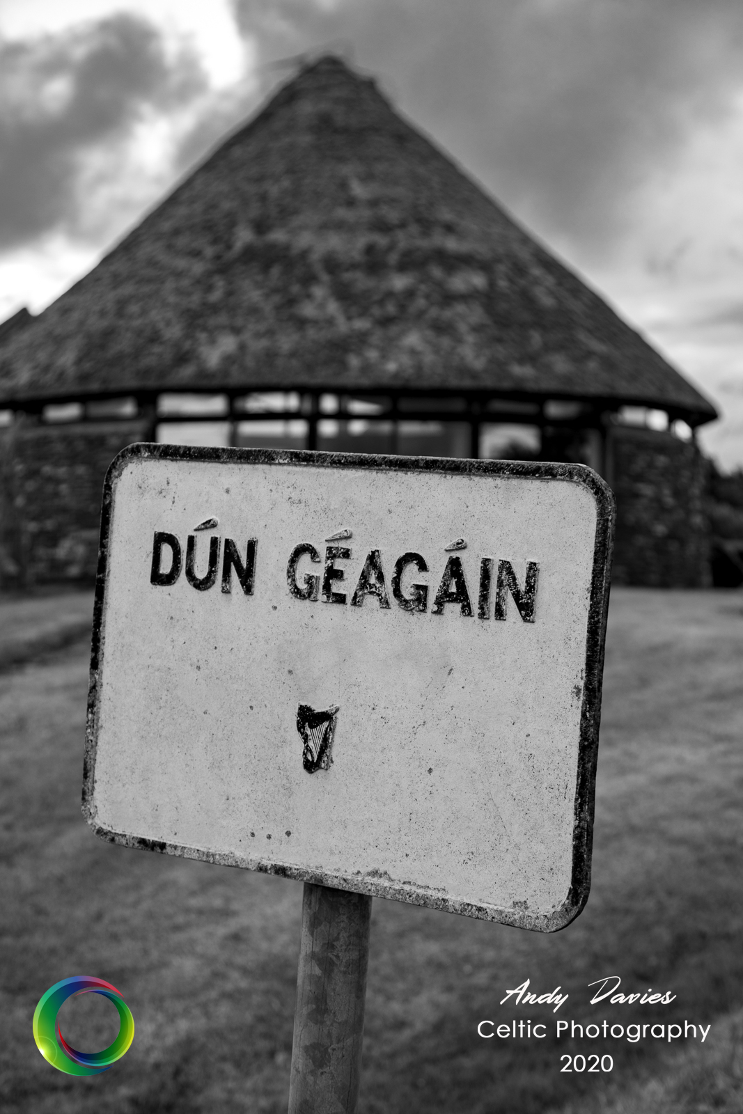
Heading down to Kerry from Dublin is a fair old trek, after 2 hours on the road you reach the delightful town of Adare in Limerick. It’s one of those gateway towns, you know the type, when you get there you could be forgiven for thinking you had nearly reached your destination. Gone are the boring soulless motorways where the speed dial tickles 120kph replaced with narrow winding roads, imposing mountains and beautiful stretches of wild Atlantic coastline. The fact the first section is over 200km yet the remaining 150km takes even longer tells you all you need to know. My destination of choice for this trip was the townland of Dún Géagáin just outside the village of Baile’n Sceilg or Ballinskelligs to give it it’s anglicised name. As the name would suggest, it’s a Gaeltacht region, an Irish speaking area, although with the scarcity of population around these parts you’re as likely to hear braying donkeys or errant tourists as you are to hear the soft lilt of a Kerry gaeilgeoir.
DAY 1
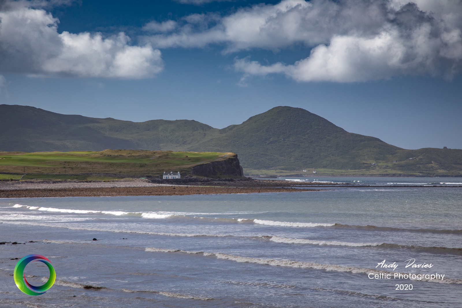
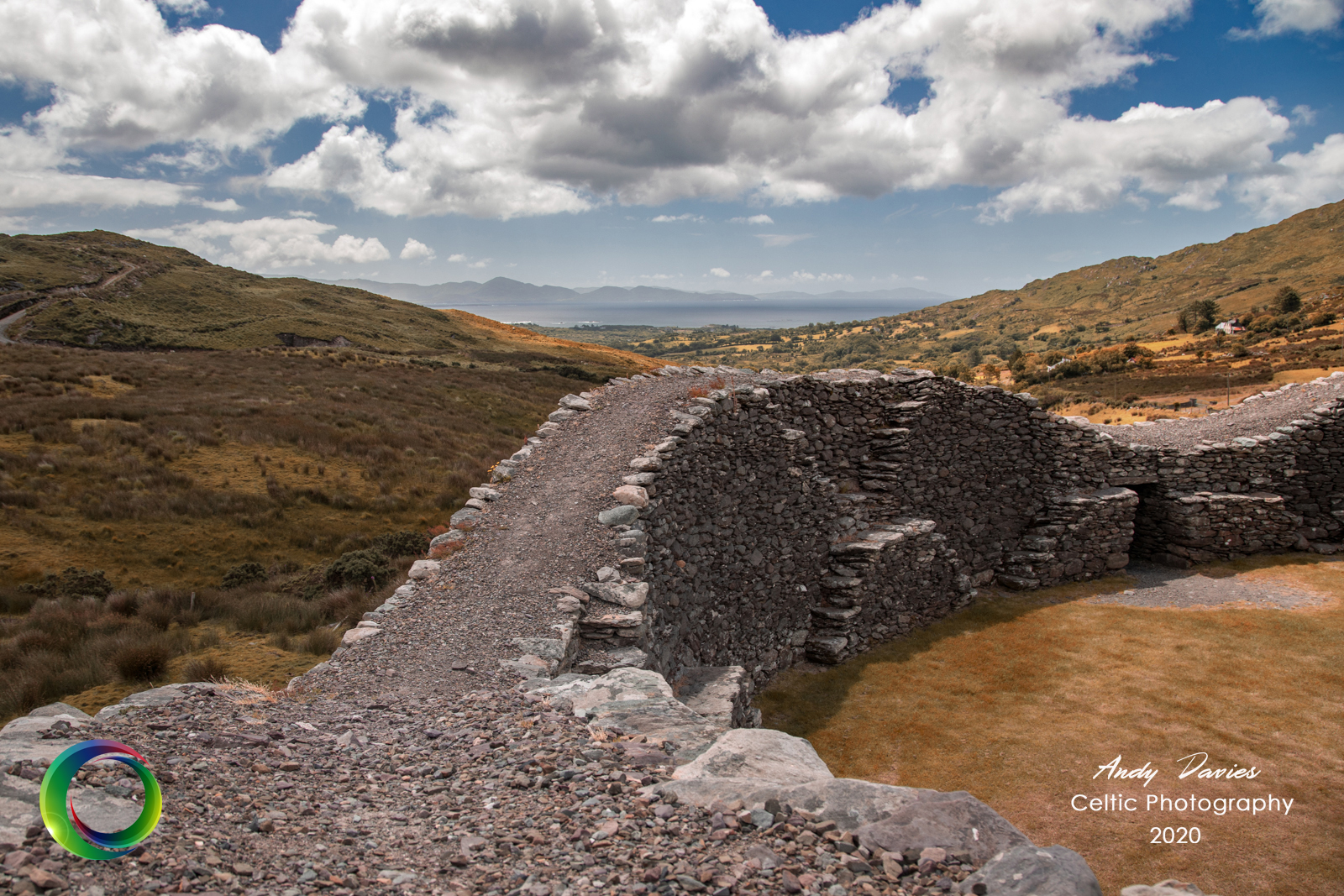
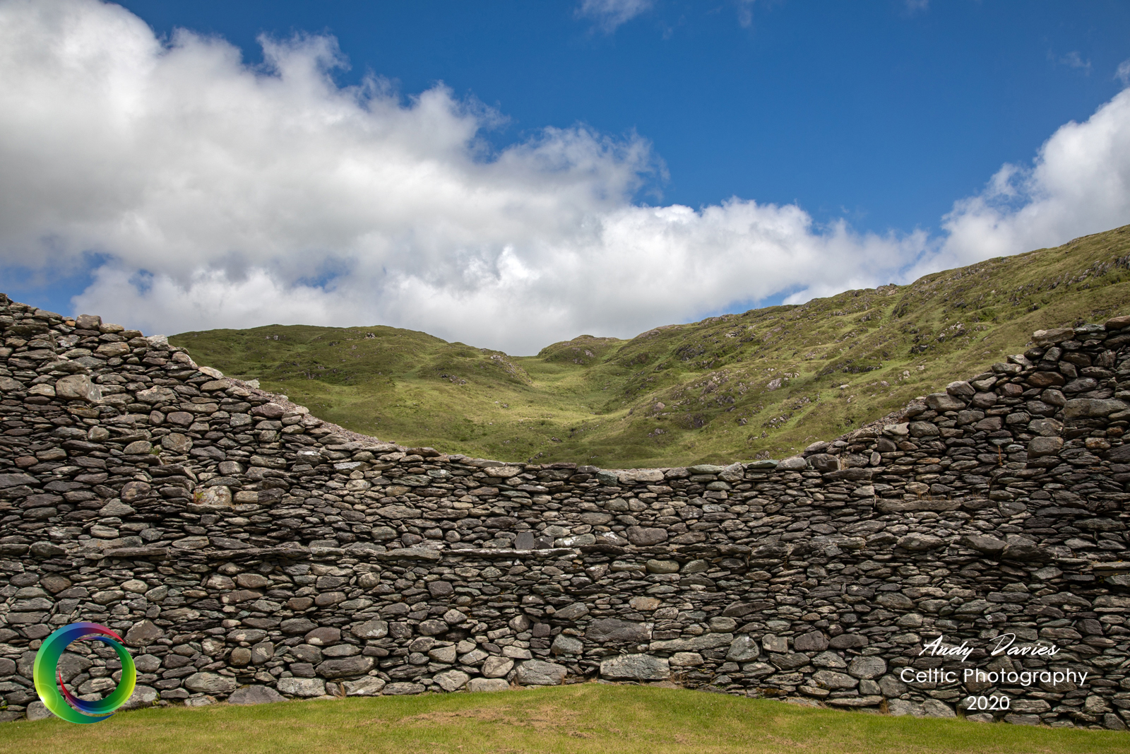
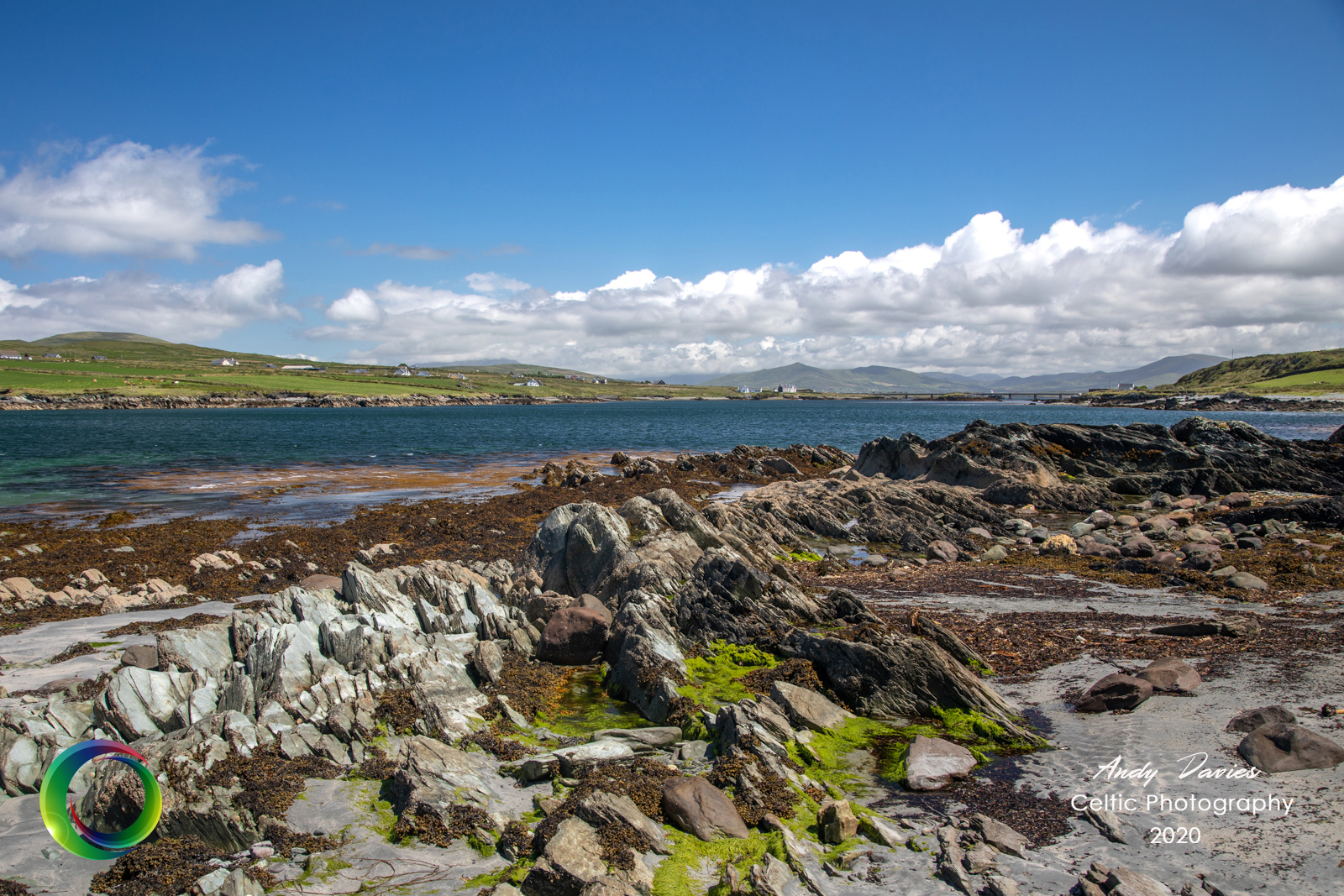
Ballinskelligs Bay is an expanse of water that separates the village from Waterville on the Iveragh Peninsula. As you travel around the bay the iconic view of the Hogs Head golf course comes into view. The town of Waterville, at first glance, is uninspiring but has an interesting past with strong links to Charlie Chaplin, and Mick O’Dwyer, the most successful gaelic football manager of all time comes from here. It also has a wide array of restaurants and bars that serve fantastic locally caught fish. I took advantage of the outdoor space outside Butlers Hotel and tucked into a delicious piece of Hake for my lunch. As you leave Waterville the road immediately starts to rise and a few twists and turns later, dramatic views begin to reveal themselves. A patchwork of fields, separated by stone walls, in any colour so long as it’s green, join the sky to the sea below. There’s a handy car park and look out point at the top of the hill, Beenarourke, where you can marvel at the views of Deenish and Scariff islands beyond. A brief pit stop so that creatures of both the two legged and four legged variety could stretch their legs on Derrynane beach. It’s a gorgeous beach although prone to overpopulation. The fact that this visit took place during the post Covid-19 lockdown meant that it was quieter that normal which was a relief. Continuing along the Ring of Kerry, after passing through the small villages of Caherdaniel and Castlecove, I saw a signpost for the Staigue Stone Fort and decided to take a detour to see what lay in store. It’s an imposing structure and dates back to around 400AD. I can’t help but wonder what possessed the tribal leader of the day to build it here in the middle of nowhere but that’s why I’m a photographer and not an archeologist or historian I guess.
DAY 2 & 3
They say it rains for two days out of three in the west of Ireland and this week was no different as Tuesday and Wednesday were a wash out. In fact where I got sunburnt yesterday I was more likely to get frostbite today. Certainly there was no indication of the weather that lay in store for Thursday. These were days that a warm fire, a good book and a couple of bottles of vino were designed for.
DAY 4
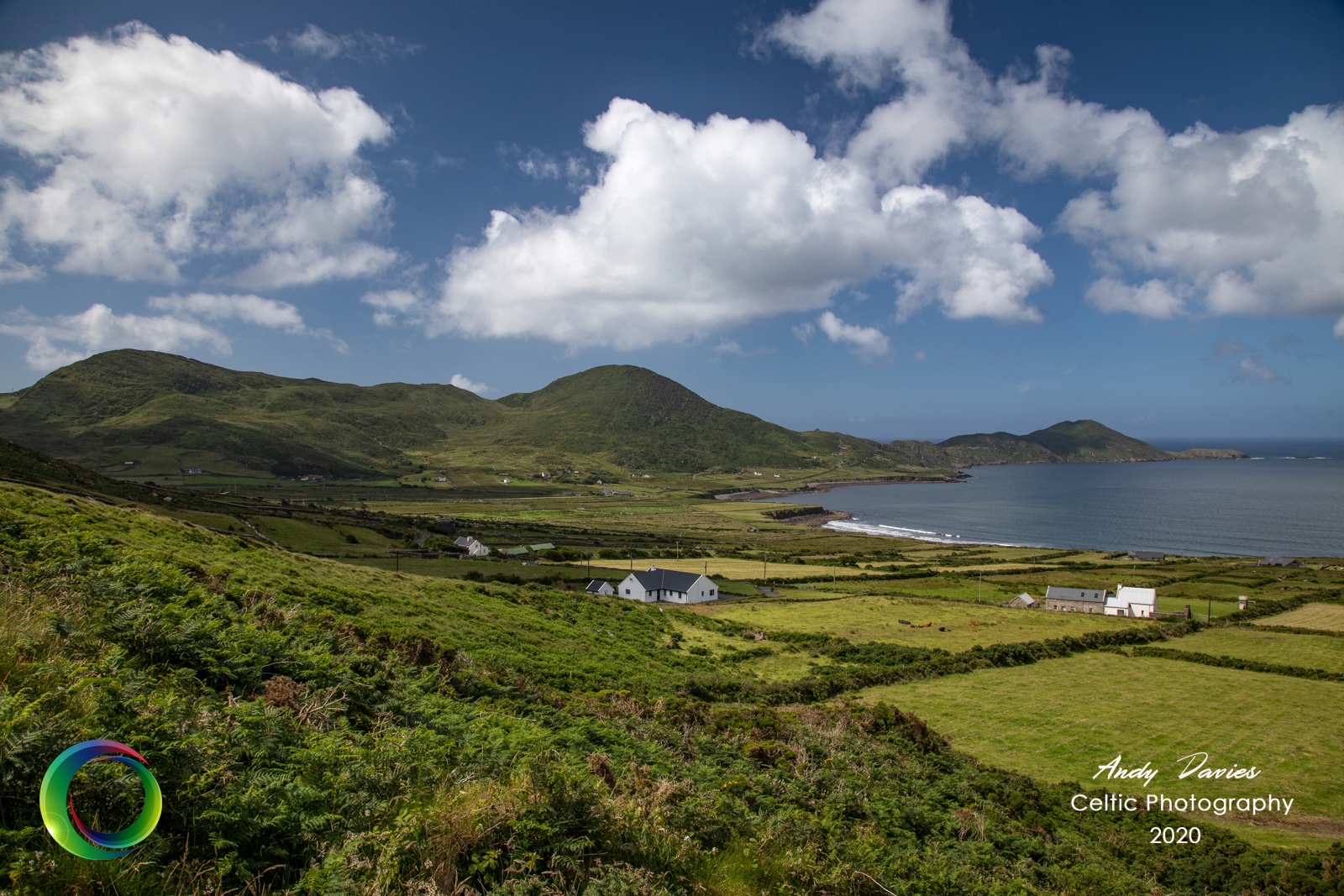
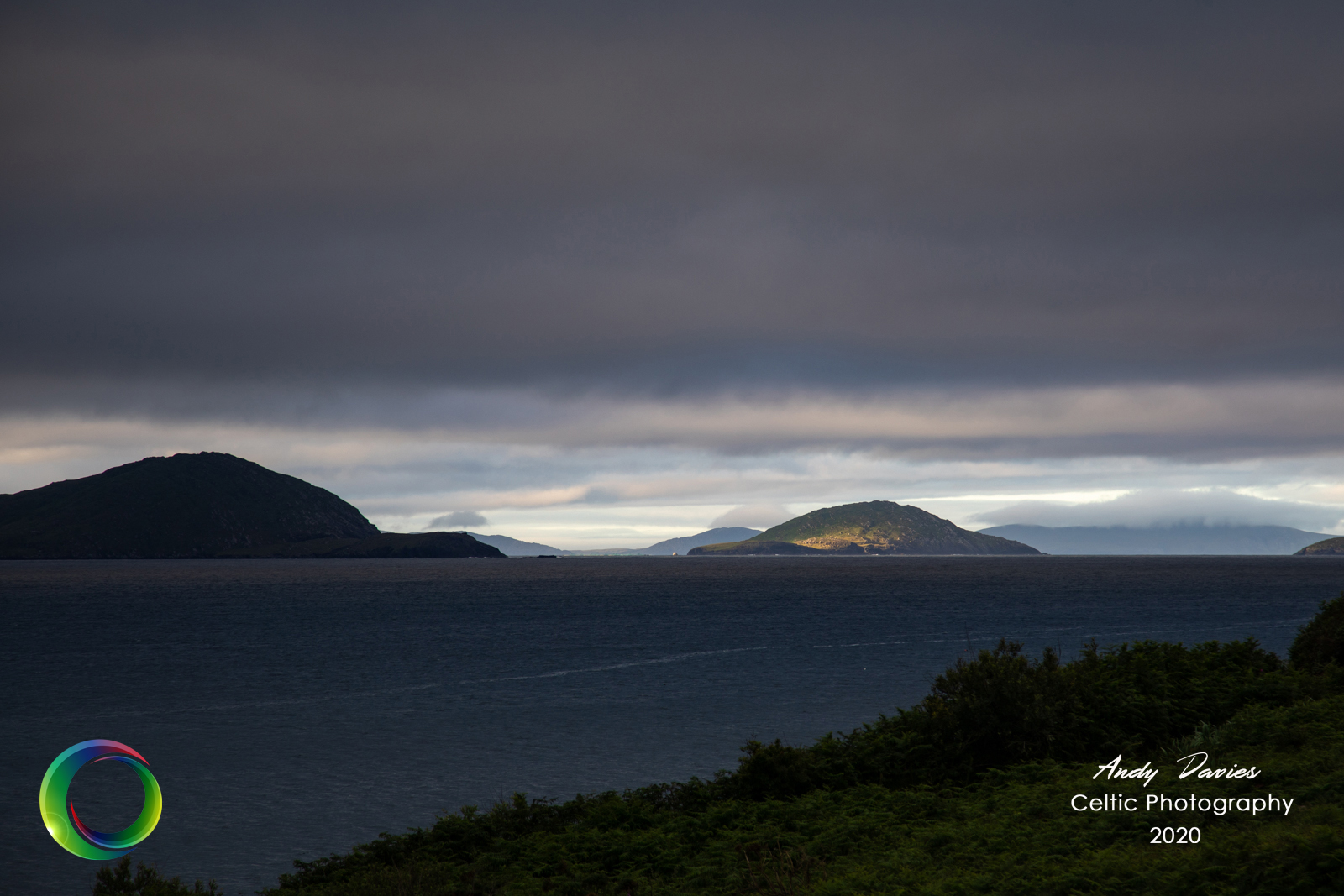
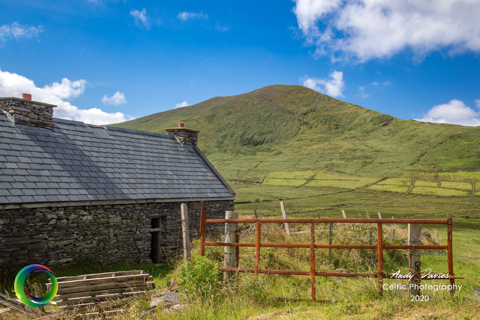
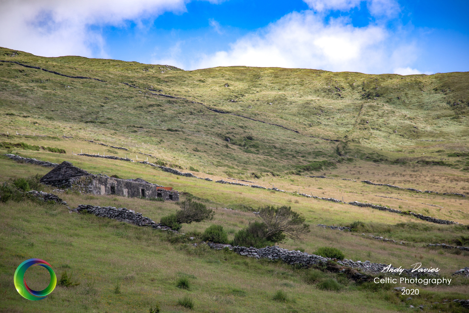
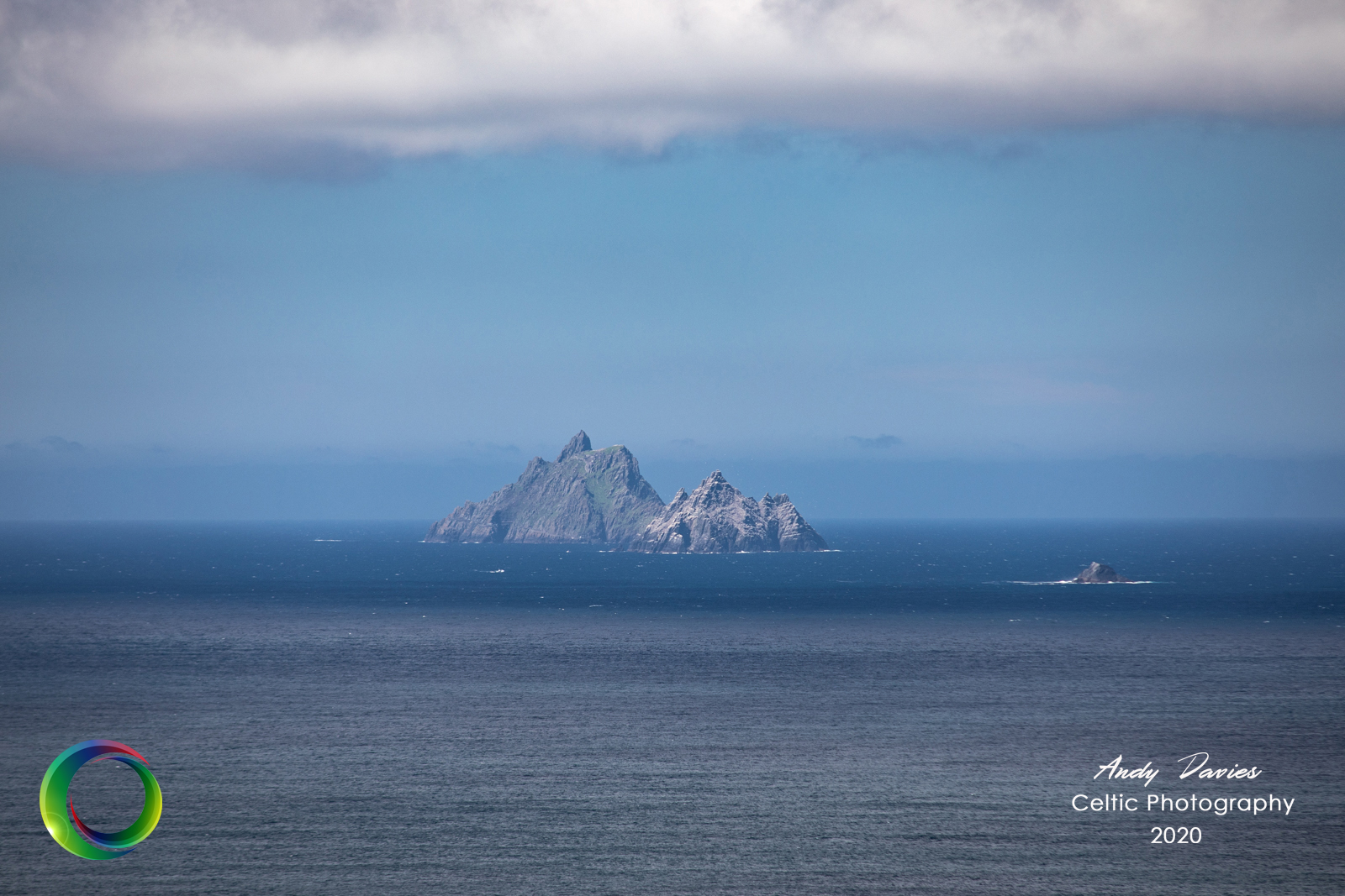
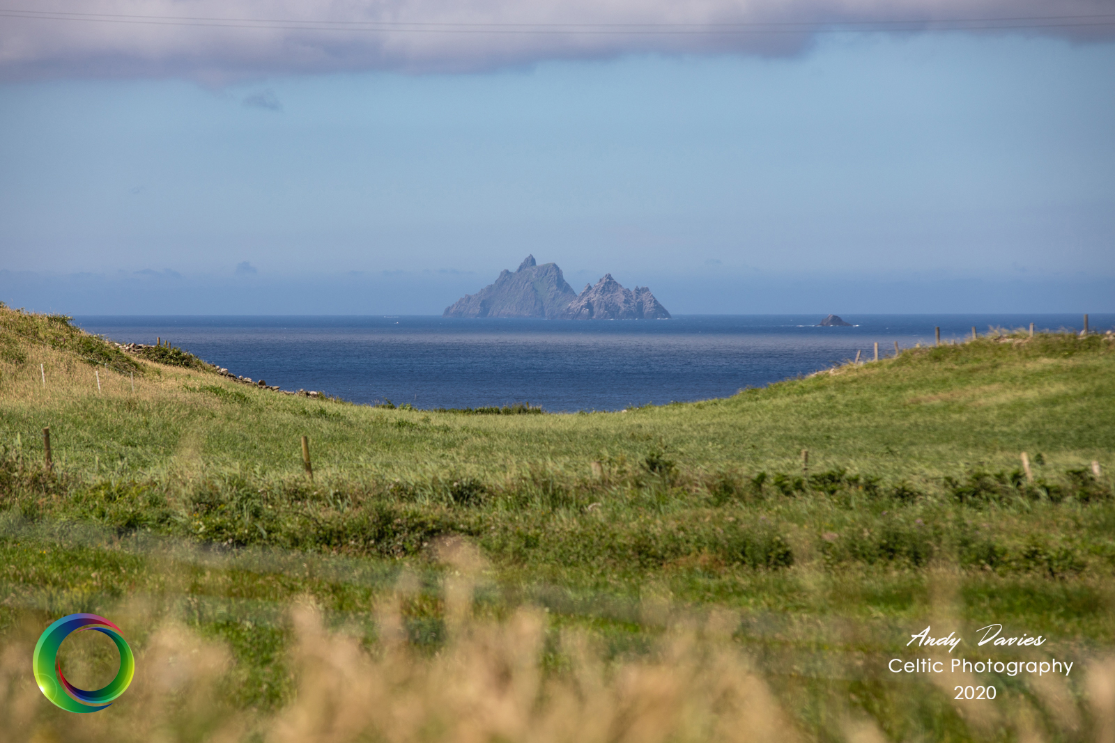
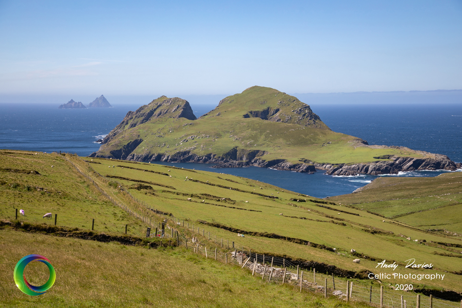
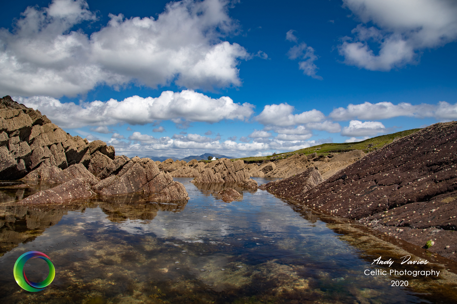
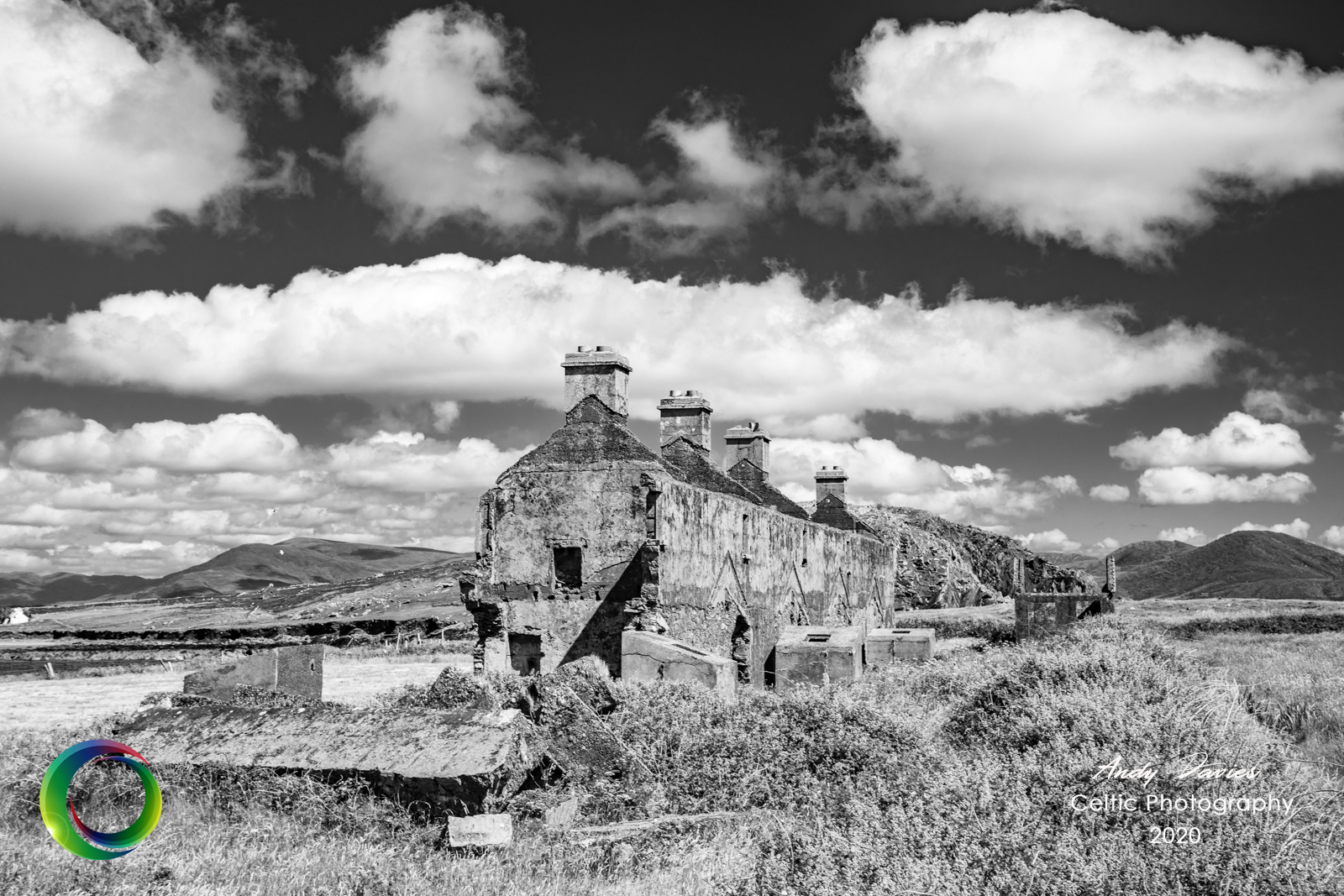
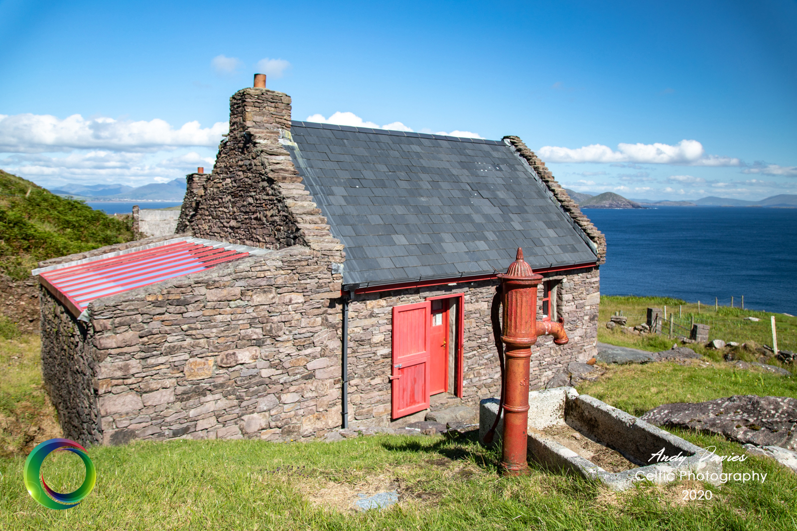
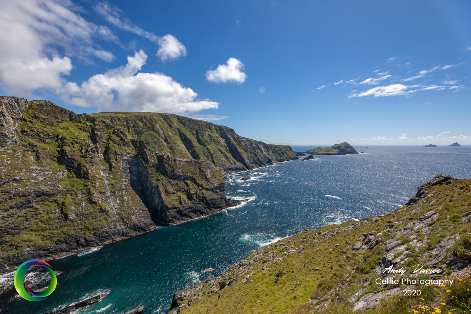
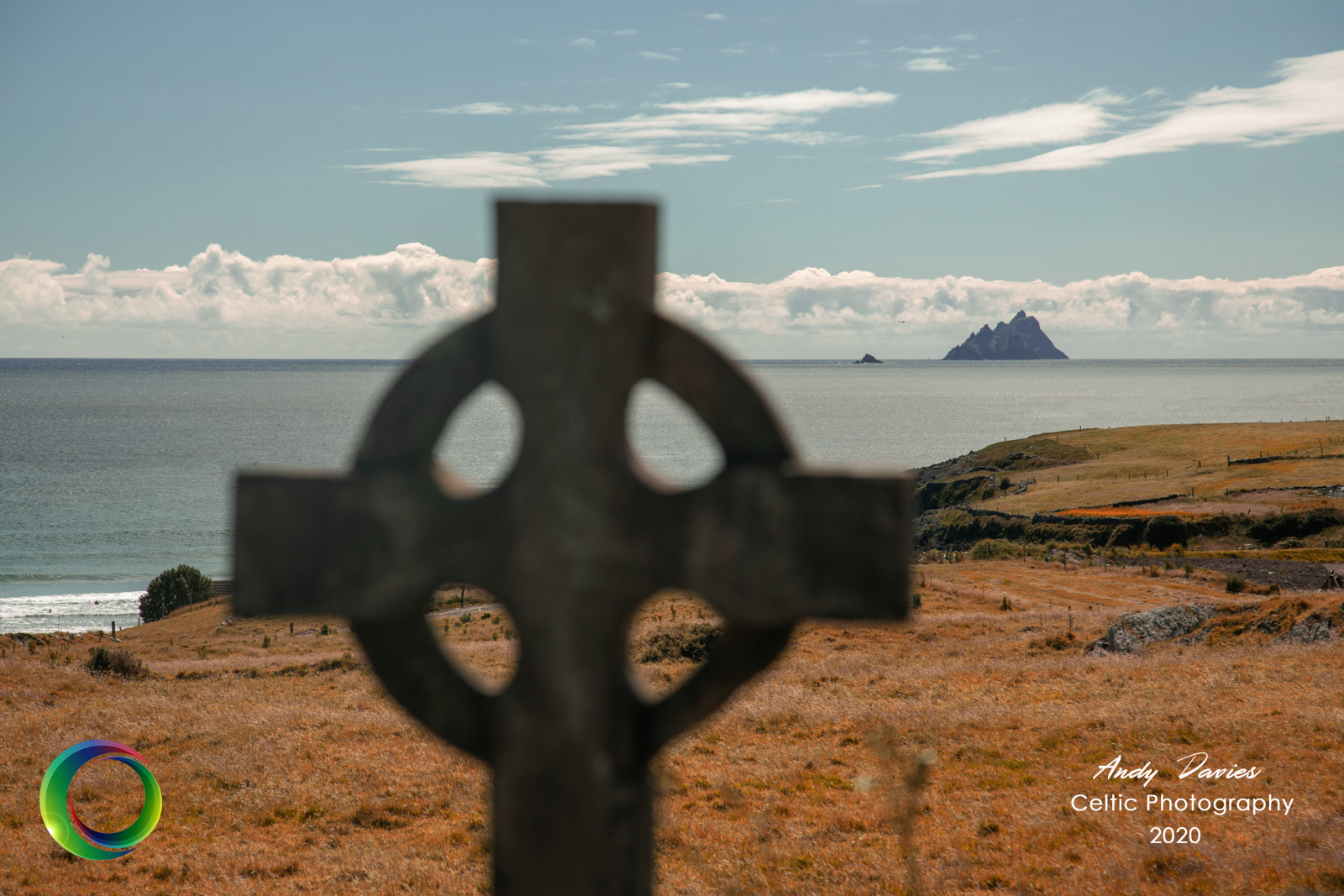
The day began with the last remnants of the previous days clouds clearing and it soon became clear it was going to be a cracker. Many miss out on the Ring of Skelligs, sticking instead its more well known cousin the Ring of Kerry. I’m probably biased but there is something a little bit special about this part of the county. Whether it’s because its less commercialised, wilder, more isolated, I don’t know but I love it. It’s a hop, skip and jump from where I was staying yet can take hours to traverse properly. I’ve done this trip several times now but I never tire of the views. The most obvious focal point are the majestic Skellig Islands which dominate the landscape in these parts. They first come into view just before you reach St Finans Bay but there’s a turn off to the left just before you got there towards Bolus Head. It’s possible to walk the whole way along the head which will bring you back to Ballinskelligs but I wasn’t that brave. Meandering along whether by foot or car you watch as the mountains rise and fall in almost perfect harmony with the islands. A reminder, if any were needed, of the history of the famine and more recent struggles for the local population can be seen with the number of derelict and abandoned properties that adorn the landscape. Many have seen new houses built alongside but in the main, the hills are covered with stone buildings that are testament to another time.
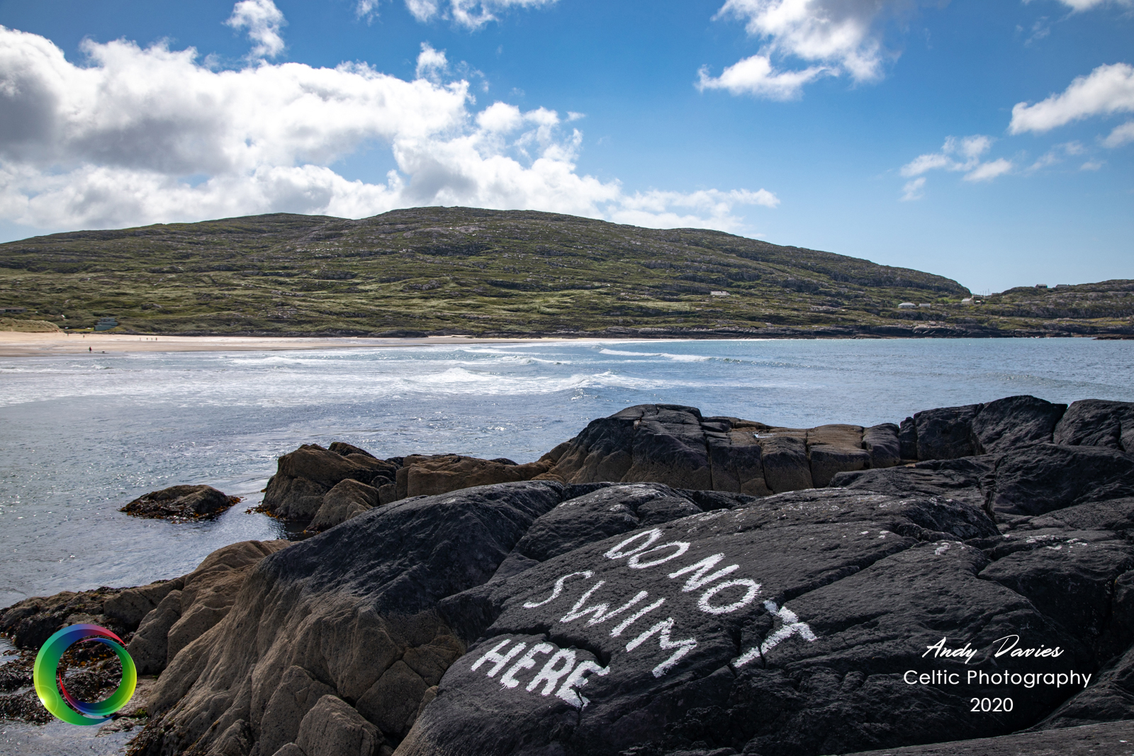
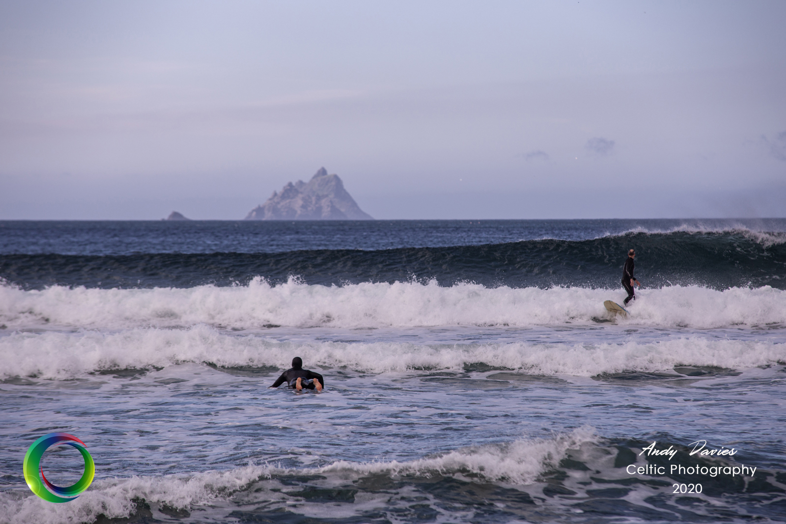
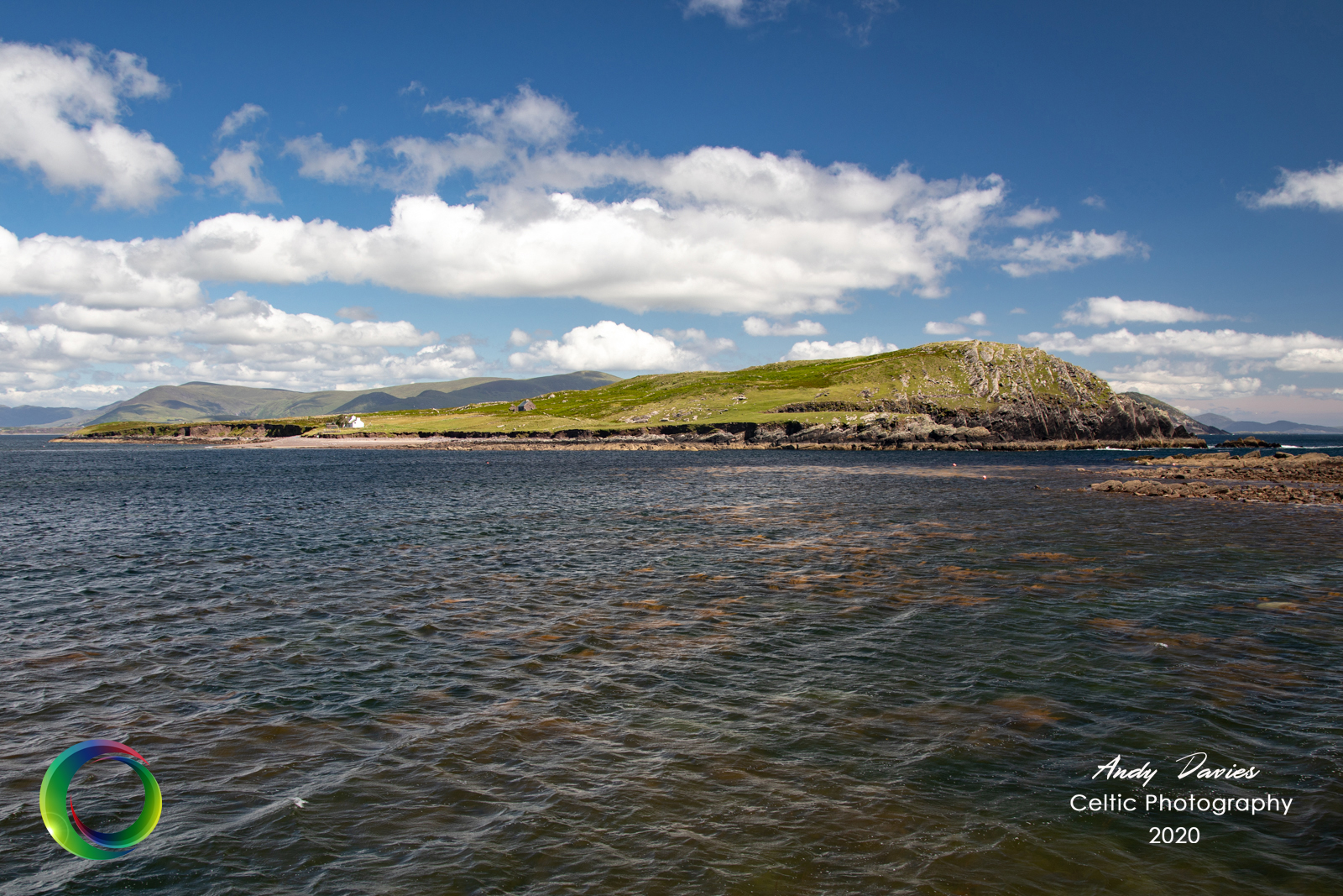
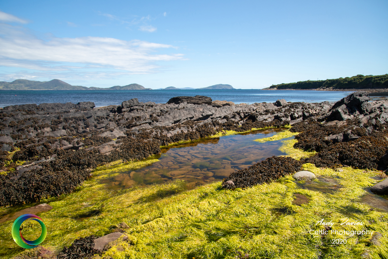
The road ends as abruptly as it begins so unless you decide to take on the long walk around the head, you’ll need to stick the car in reverse and return to the main road. The wonderful St Finan’s Bay or St Finian’s Bay comes into view as you start to descend this hill and it’s a glorious place to wile away a few hours. If you haven’t tried Skelligs Chocolate yet then you’ve missed out. The factory where it’s made is located here and there are tours available if you wish. Mint brittle is to die for! Anyway, I couldn’t resist taking a break and joining the surfers (albeit from the safety of terra firma) I took the opportunity to shoot a couple of these images just to feature why so many love this part of the country. As you continue on, there are a number of small lanes that lead off the main road and, whilst respecting the local population, it’s well worth a detour if you can. This particular one leads to a point where there are great views of Puffin Island and the Skelligs beyond.
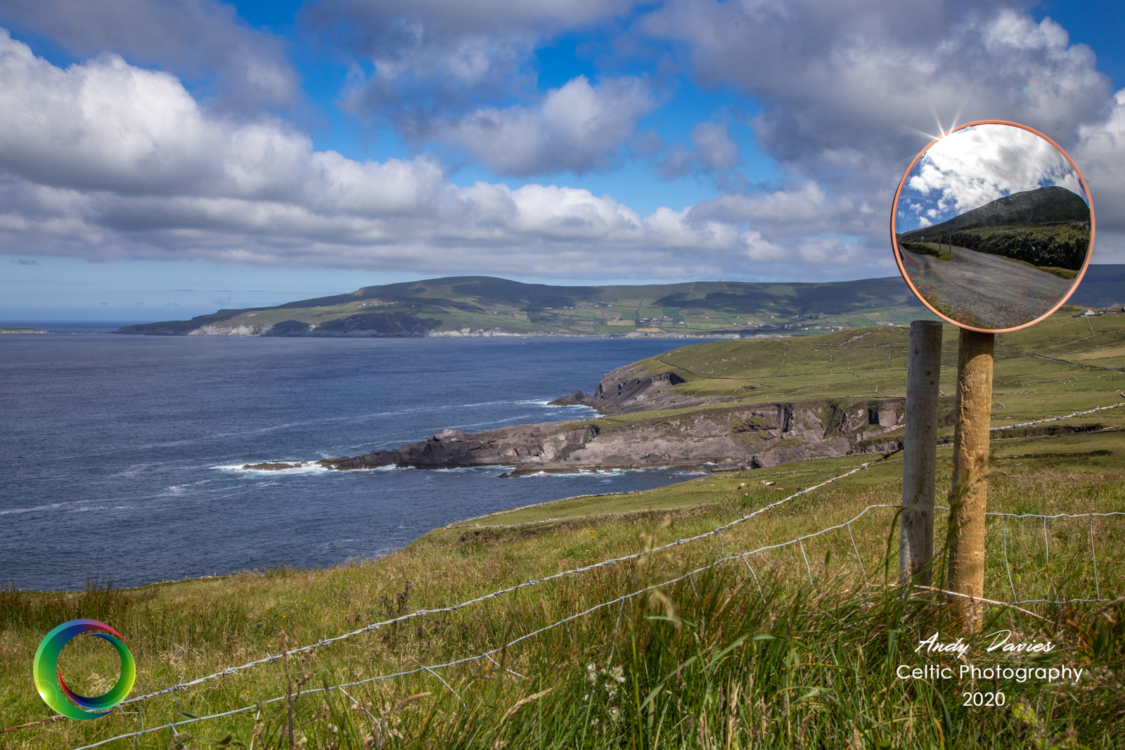
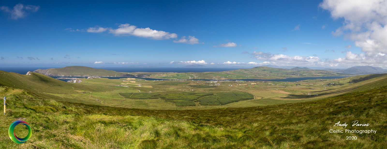
From this point you start to climb the hill on the other side of the Glen and it’s impressive although my car thought it less so. I felt for all the cyclists struggling their way up the mountain and waved sympathetically as I drove past! I believe this part of the area is called Allaghee Beg, although I’m happy to be corrected on this. The wind up here is a major shock to the system but once again the views are extraordinary. The landscape changes slightly in my opinion but is no less dramatic as the mountain makes its way down to Portmagee and Valentia Island beyond. If you’re that cyclist then this is one of those moments to ensure your brakes are in working order. I’d imagine if you freewheeled down here you wouldn’t need to start peddling again till you reached New York.
Lunch was a pit stop in the picturesque village of Portmagee. Ferries for the Islands depart from here with lots of Star Wars fans on board. Whilst you can understand the local community making hay, as it were, from the Star Wars franchise, it’s nonetheless disappointing to see such a historic and beautiful landscape destroyed by commercialism. I’ve come close to making the trip but can’t quite bring myself to. Once upon a time you could befriend a local and hitch a lift aboard one of the many fishing boats that moors in the harbour but not anymore. Now it’s official trips only and you pay €40 for the privilege. A trip I will probably make one day but that’s for another time.
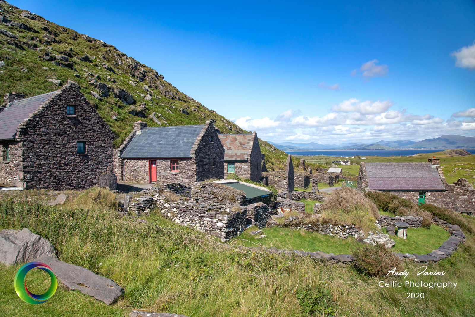
Heading out on the Cahersiveen road, a right hand turn brings you back to Ballinskelligs and cut’s through the mountains to return you from whence you came. It had been such a stunning day though, I decided not to return home quite yet and instead made my way up to the old famine village of Cill Rialaig (Kilreelig). It’s now home to an artists retreat, who reside here for weeks at a time satisfying their creative juices. It’s a great initiative by the Arts Council and most notably Noelle Campbell-Sharp who raised funds to renovate some of the houses back in the early 90’s. It’s a beautiful walk and offers yet more lovely views of Ballinskelligs Bay, the Beara peninsula and Dursey Island beyond.
DAY 5
The weather had turned so pleasant that I stayed on an additional night. The morning promised great things so I set the alarm for 5am and woke at 4.58. Isn’t it weird how that happens?
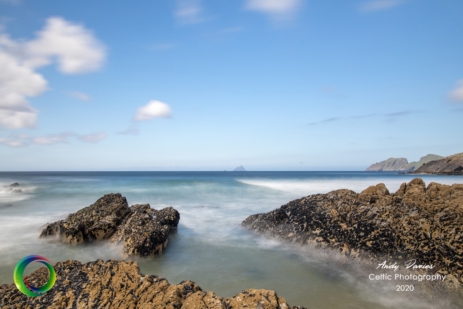
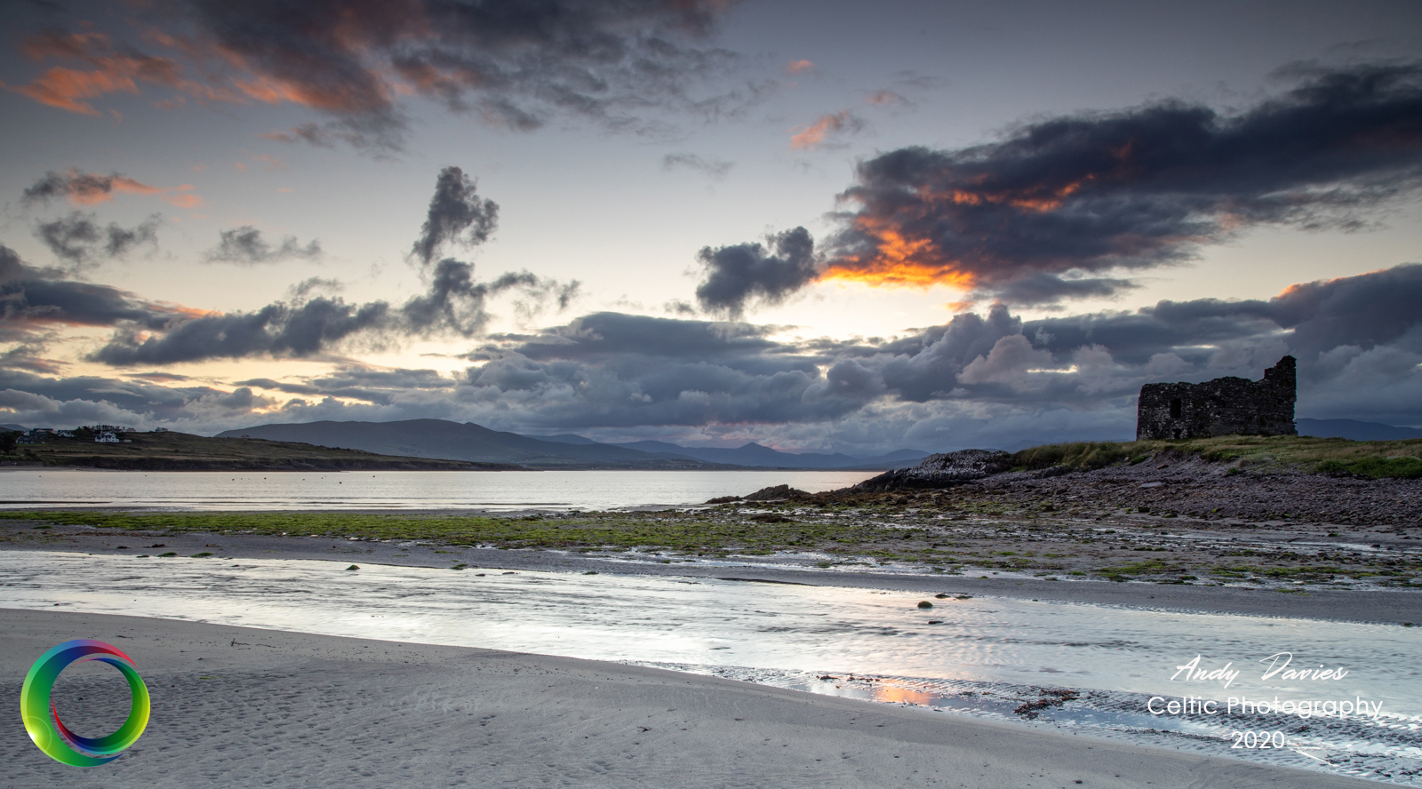
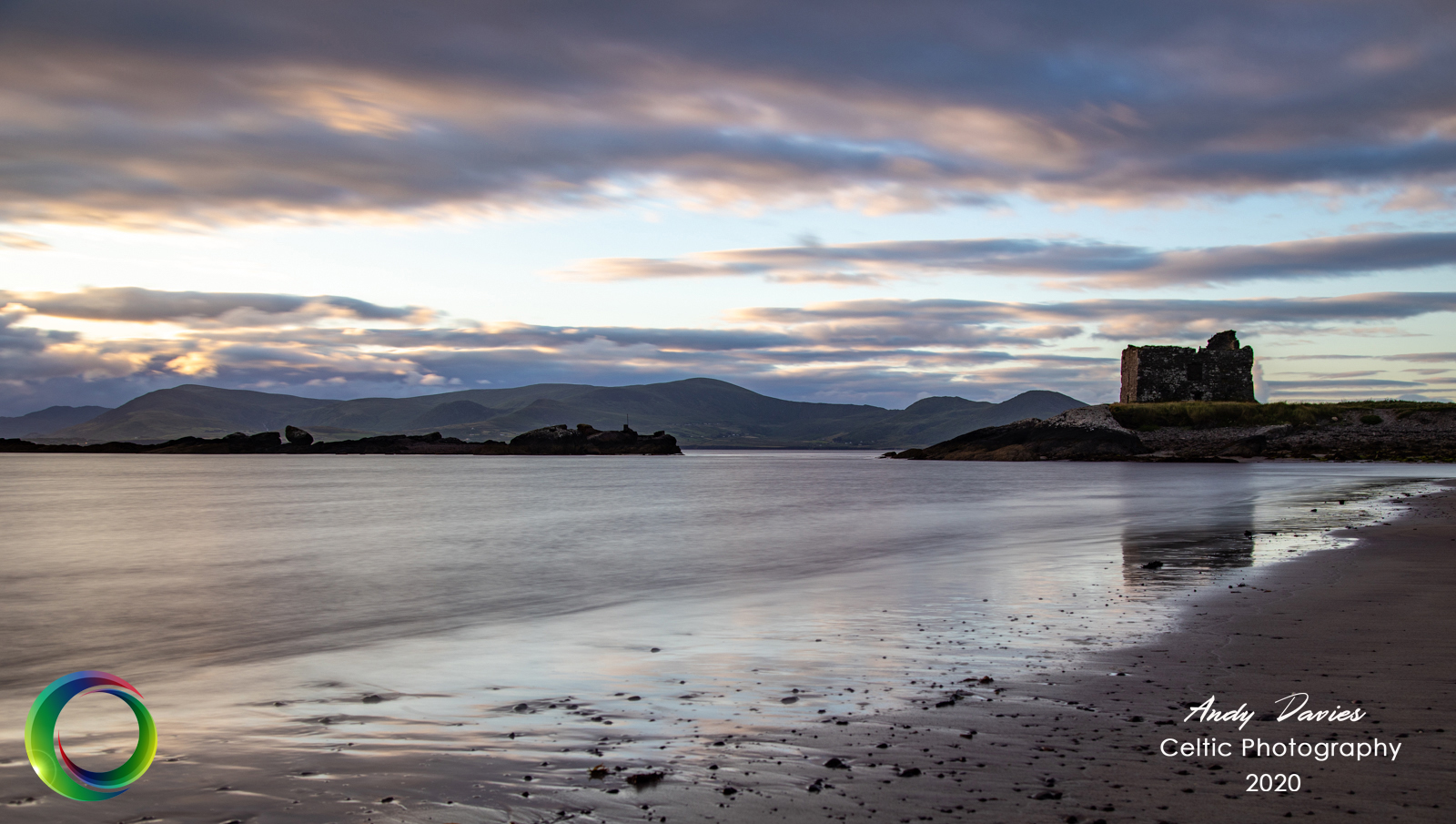
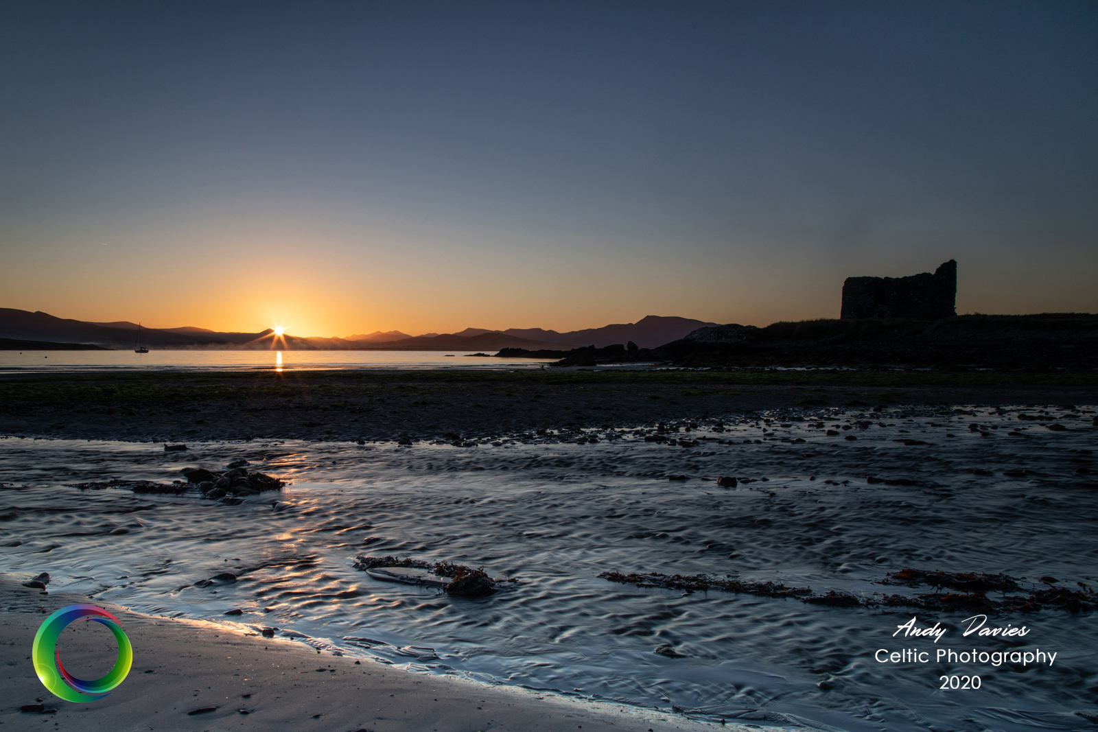
I headed down to Ballinskelligs beach, a stones throw from Dún Géagáin, and to McCarthy’s Castle or McCarthy Mór Tower House to give it its proper name. The sun never really made an appearance, blanketed by early morning cloud over the Killarney National Park, yet the skies were incredible. A beautiful array of colours blasted out in all directions and lit up the Abbey and mountains beyond. I shot what I could and got drunk on the stunning morning light. There’s a danger sometimes that we obsess with getting that perfect shot only to forget to experience the view before you.
There’s a small coffee shop at the beach which was taking all the proper COVID-19 precautions. After your coffee, tap on the hatch next door to get very useful tourist information…although you could just ask the girls in the coffee house as they are one and the same!
In the morning, I took a stroll around the Reenroe, the beach that almost joins Ballinskelligs with Waterville and is home to an abandoned hotel. It’s an eyesore but has been part of the landscape for many decades.
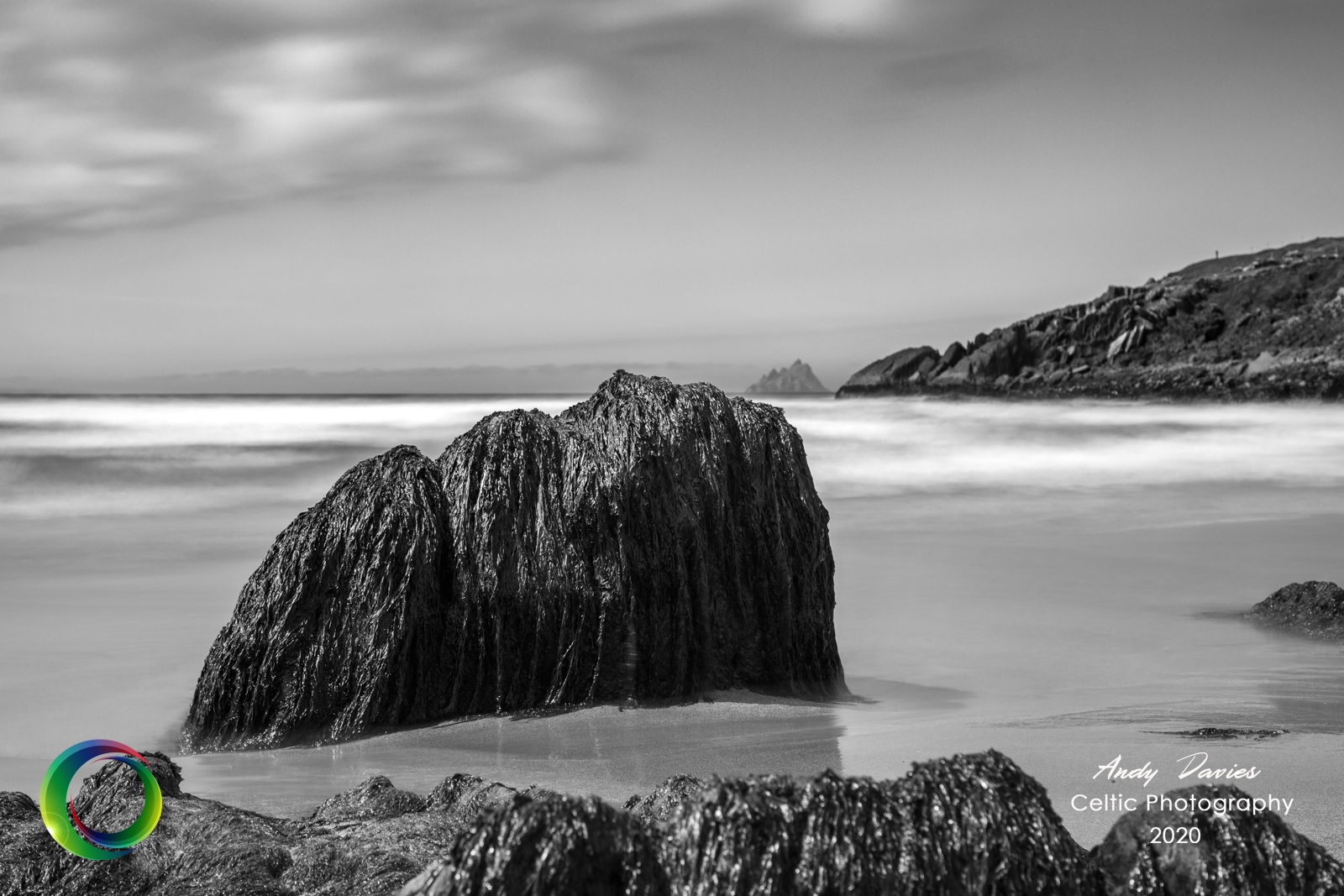
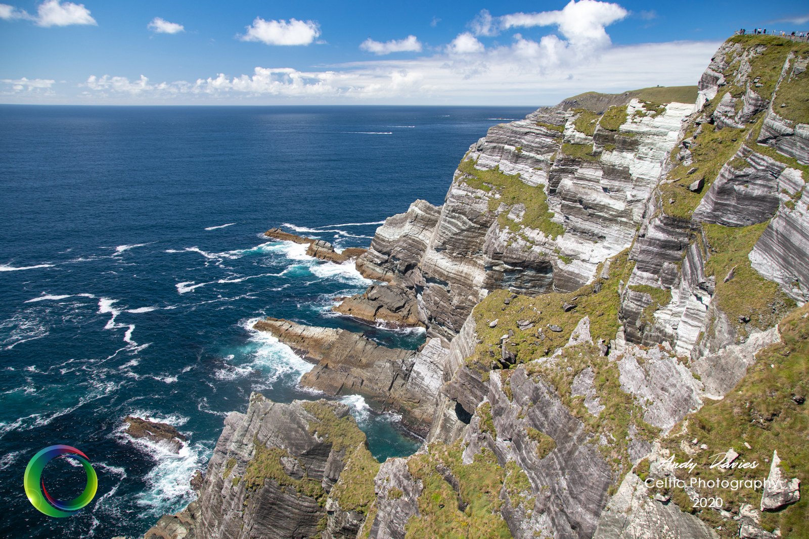
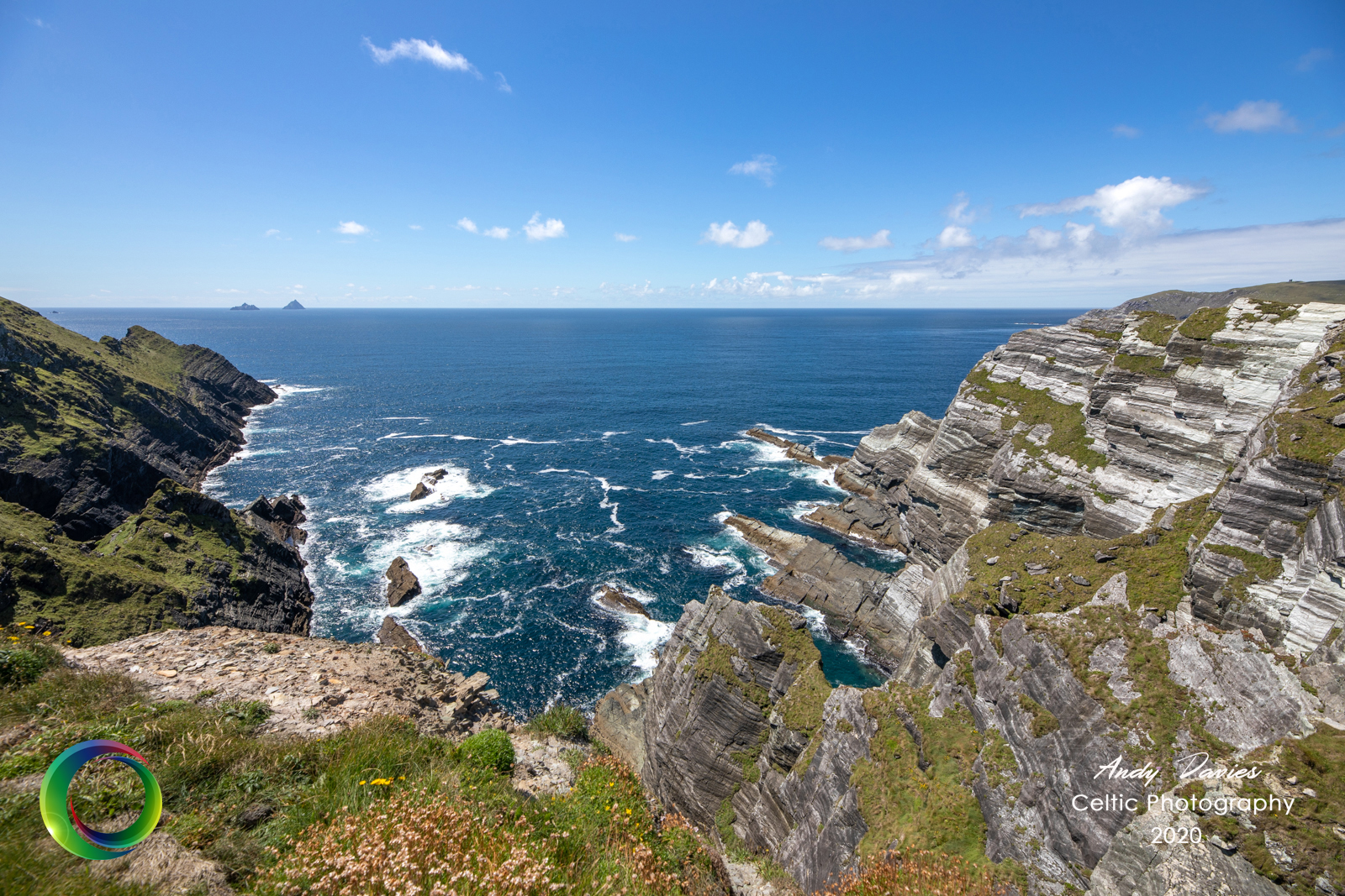
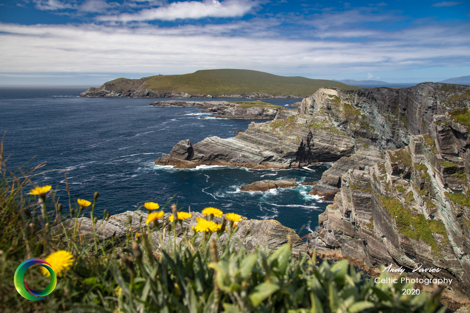
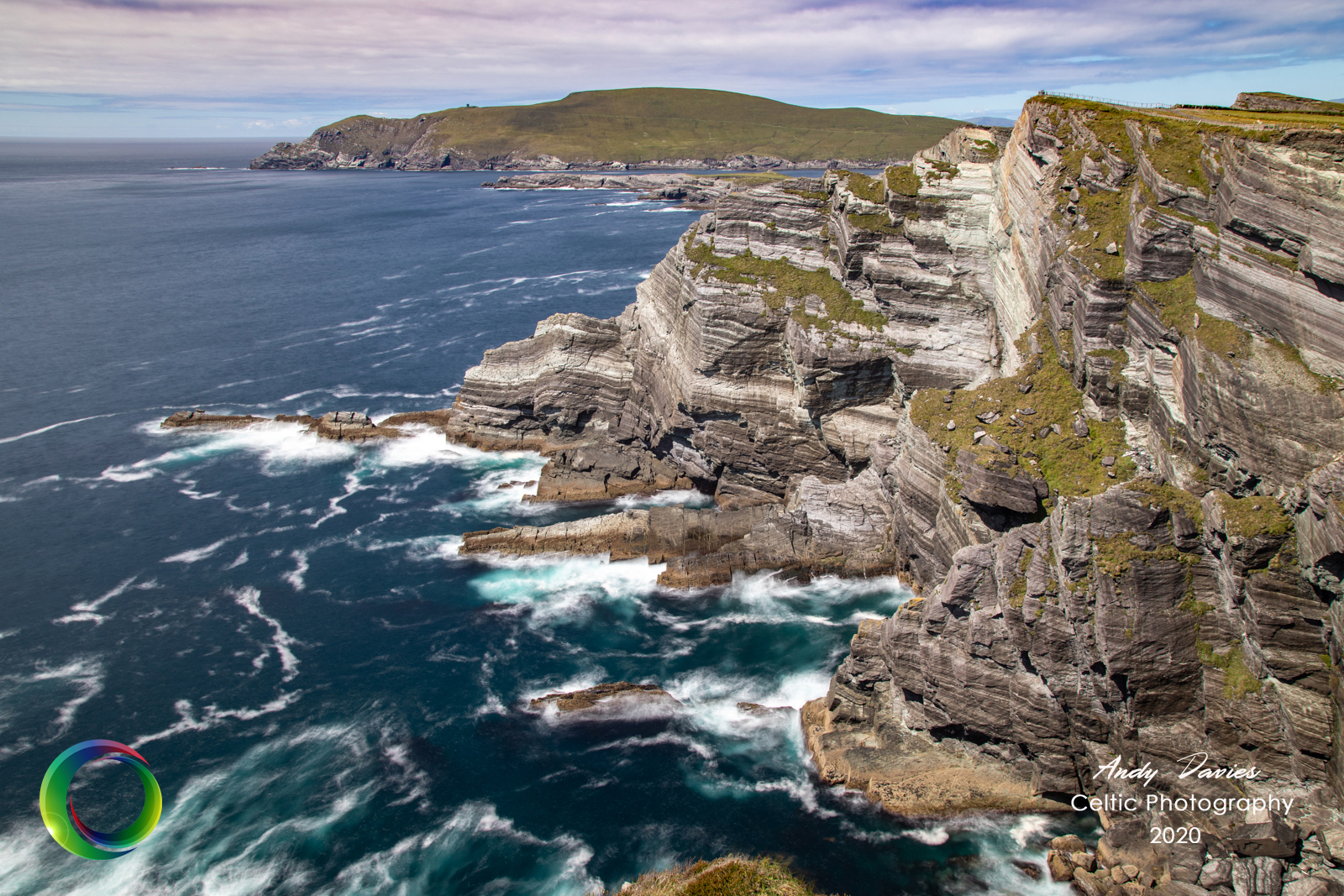
In the afternoon I headed up to the Kerry Cliffs. Half way down the hill to Portmagee there is a small understated cafe and car park with signs for the Kerry Cliffs. Whether you come from the Glen or from Portmagee, the climb should give you some indication of what lies in store but it’s still a bit of surprise just how dramatic these cliffs are. They rarely get mentioned in the same breath as the Cliffs of Moher or Sliabh Liag (Slieve League) but they are a match for either in my opinion. The last time I visited there were just one set of cliffs viewable but now with walks developed in both directions it’s possible to see 4 different cliffs from opposite sides and, of course the majestic Skelligs in the distance. I spent a good bit of time here soaking up the views and lugging my tripod and gear up and down the newly manicured paths.
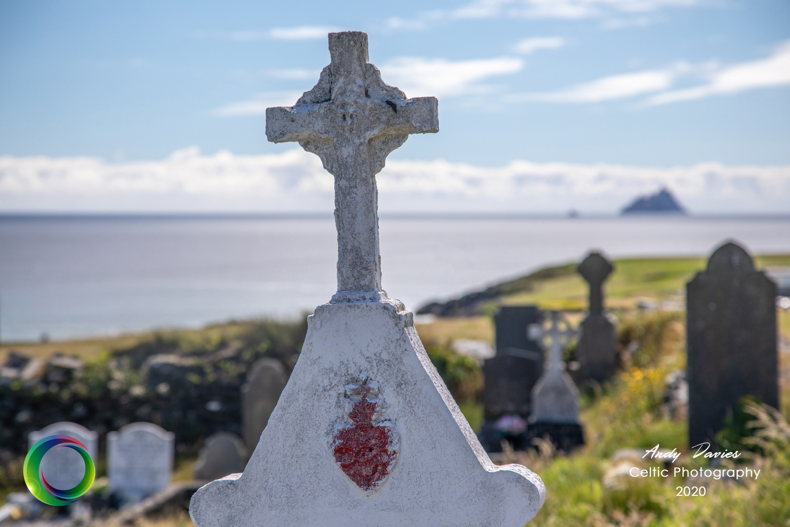
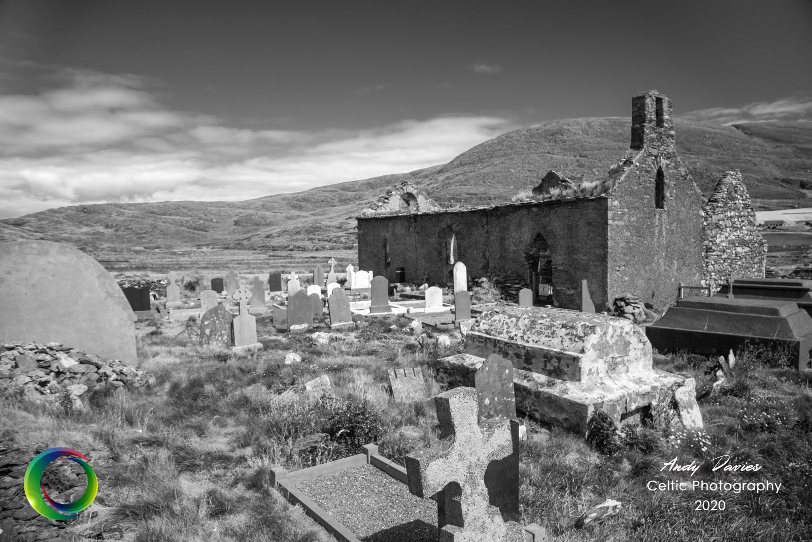
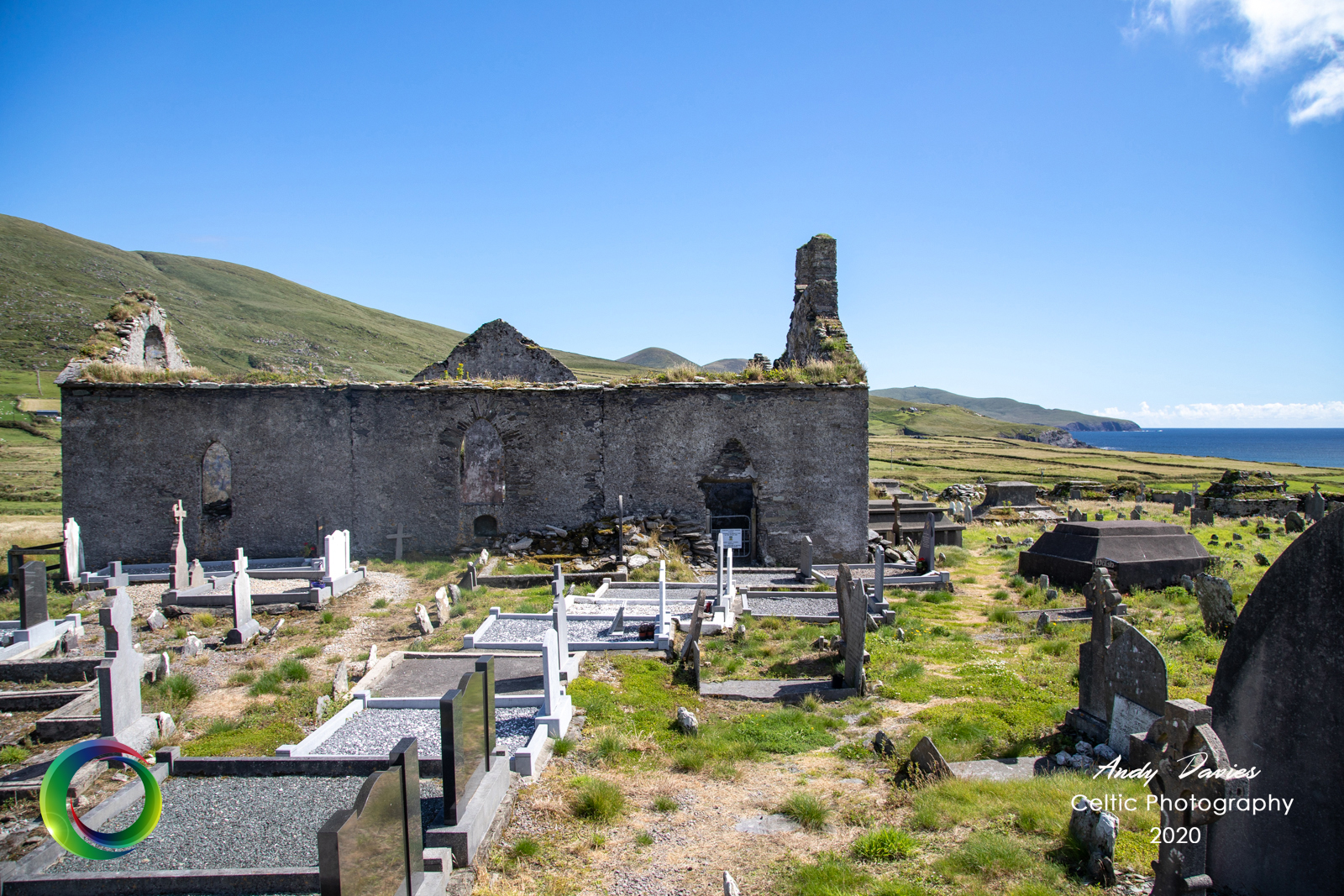
On the way back to Dún Géagáin I stopped off in the Glen again and took a couple of snaps of the old derelict church that overlooks the parish. Hundreds of graves are marked with nothing but a chunk of stone reflecting perhaps the hardships that families suffered during the last two hundred years. I assume it was Kerry County Council that mapped the graveyard and it’s to their credit that they have revealed the name of everyone who’s buried here as well as in Ballinskelligs Abbey.
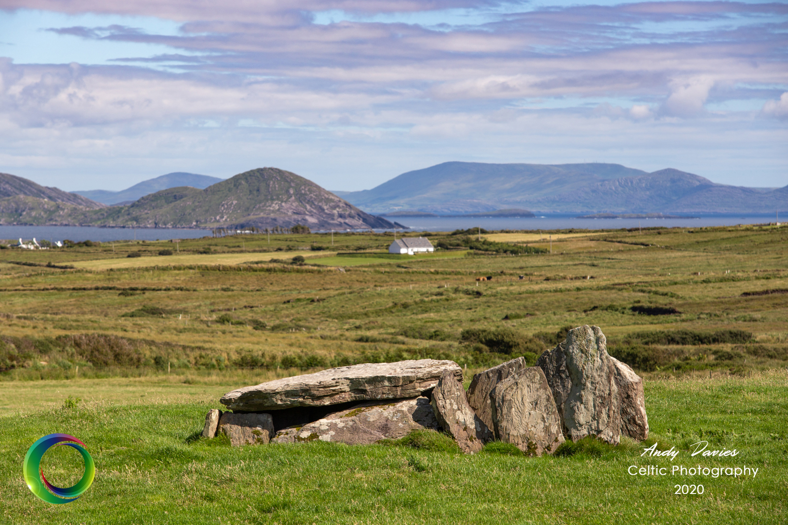
It’s often the case when you drive the same road in opposite directions that you’ll spot things you may miss first time around and this was the case today. On the long stretch of road leading back into Ballinskelligs I spotted an old unmarked burial tomb. Its unassumingly positioned in the middle of a field with only sheep and cattle for company. There are no signposts to explain the history but a quick google search reveals its a wedge tomb and this part of Ballinskelligs is called Coom. I suspect that monuments such as these are so plentiful in this part of the country that it seems overkill to restore the grounds of each one. As it is, there is something a little magical about finding treasures such as these under your own steam as it were.
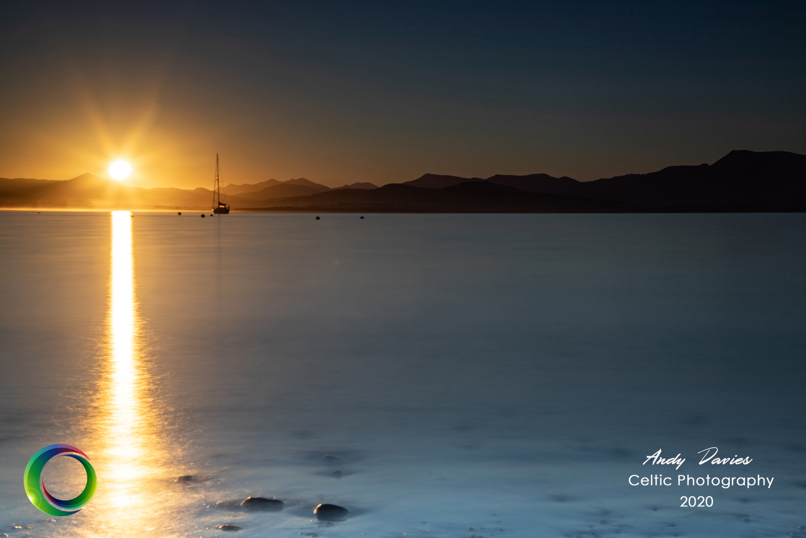
DAY 6
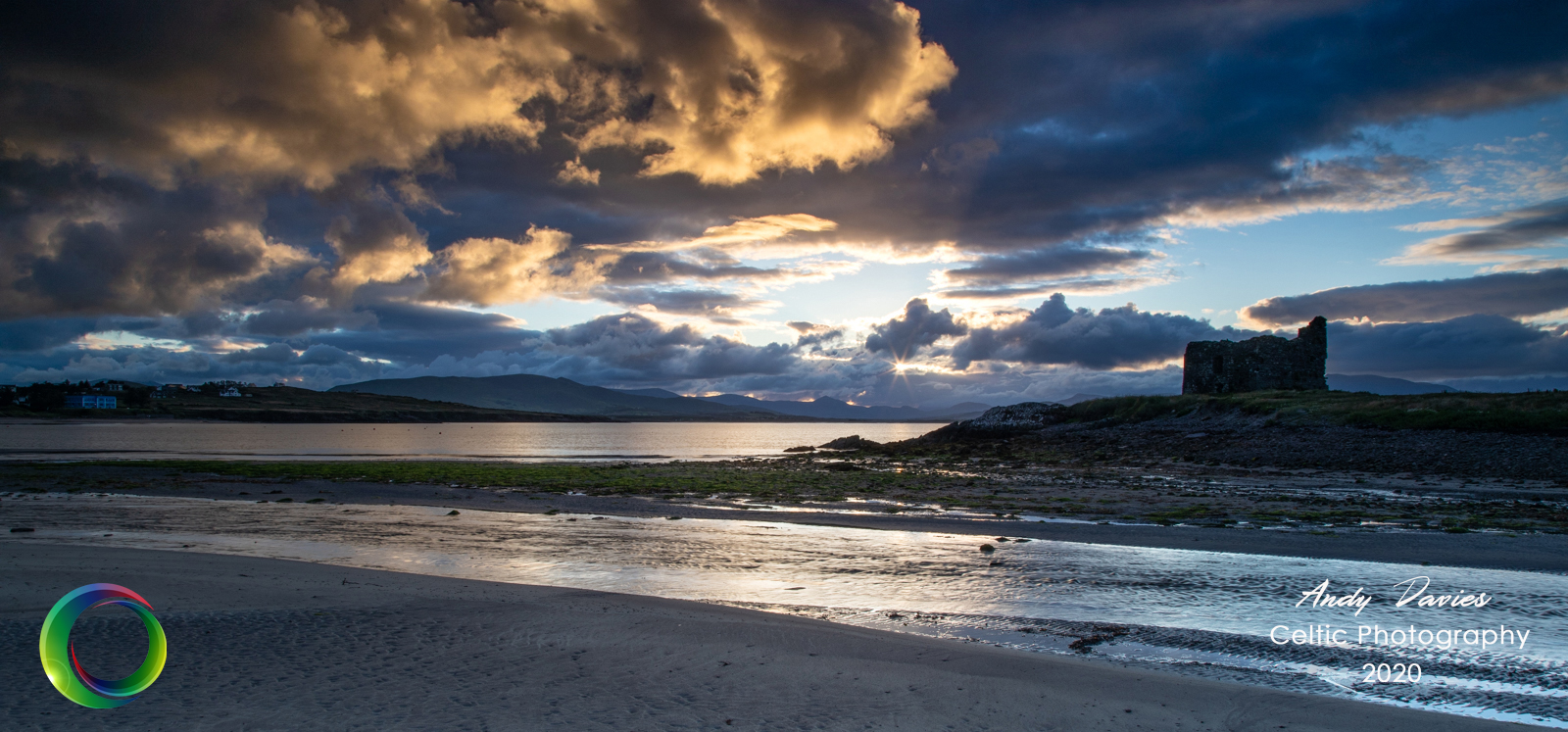
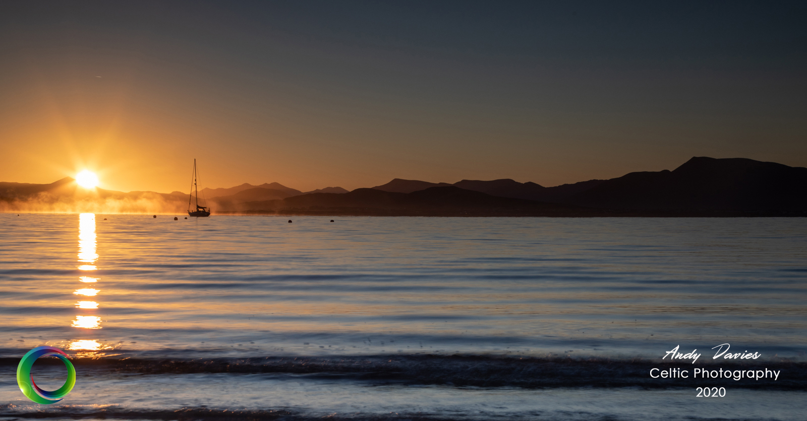
The beauty of an extra day meant an extra morning. I wouldn't normally be in the habit of more than one 5am start but with the promise of a clear morning this time I set the clock once more and ventured back to the beach to see what I could get. I was lucky that a boat had moored close to the beach which added a bit of subject to the image. The final shots reflected what had been a magnificient week. They don't call it the Kingdom for nothing


Comments
Leave a comment